Managing flows on the Chehalis River
The era of dam building is over. In 2018 alone, 86 dams were removed from rivers and streams in the United States. 550 miles of streams and rivers were returned to a free-flowing state, generating an ecological revitalization comparable to that seen on the Elwha River after dam removal.
However, on the Chehalis River, flooding continues to threaten people, farms, churches, businesses, and communities, and planners are thinking about a new dam. Recent flooding has been exacerbated by climate change-fueled storms, aggressive logging in the headwaters, and construction of major transportation infrastructure (including I-5 in the floodplain). A sense of community trauma still lingers if you speak with people who lived through the floods of 2007 and 2009.
A free-flowing main channel
The Chehalis is one of Washington’s grand coastal rivers and with the most robust wild salmon population of any river in Washington State. While there are no dams on the main channel today and populations of salmon are not listed as threatened or endangered, the populations of spring and fall Chinook are severely depleted. If a dam is built, the Chinook that spawn above the site of a dam will very likely go extinct. This in turn will threaten the stressed Southern Resident Orca whales who rely on these Chinook for food.
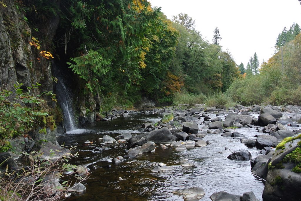
The river’s epic journey
The Chehalis River is the historical homeland of the Confederated Tribe of the Chehalis. The tribe has lived with the river and managed its flooding for thousands of years. For all those years, the river meandered without undue burden from its headwaters in the Willapa Hills to the estuary known as Grays Harbor. During heavy rains, water from the Willapa Hills was metered by huge trees whose abundant in-stream wood moderated flows. Water was diverted into adjacent forested wetlands and floodplains. The water was clear and clean, with banks full of migrating salmon.
Unchecked exploitation of the river
Much has changed since then. The river’s headwaters are now a checkerboard pattern of clear-cuts and immature trees. The channel bed and banks have been eroded by the massive number of logs being transported to mills. Gravel and sand have been mined from the channels. Shade-producing riparian forests have been cut; water is withdrawn to irrigate farms. The river receives sewage, along with polluted municipal and industrial storm water and other discharges. Downstream where the river forms the estuary, its banks are completely transformed by riprap and dredging and used by international shippers. Salmon populations are a fraction of what they once were.
Despite areas where floodplains have been turned into commercial hubs served by freeways and railroads, the river still provides. It is used for Tribal and recreational fishing, boating and swimming. The estuary supports cultivation and harvesting of shellfish and provides habitat for aquatic species including gray whales. Yet development along with increasingly heavy storms threatens to undermine the river’s health and put people, transportation systems, farms and businesses at risk.
A dam in the headwaters
The Chehalis River Flood Control District is proposing to build an expandable dam on the headwaters of the Chehalis River to reduce flood damage in the Chehalis-Centralia area. Ever since the catastrophic flood in 2007, plans have been underway to build a dam. The Office of the Chehalis Basin, created by Governor Inslee in 2017, was developed to work toward a dual strategy: flood control and aquatic species restoration.
A more effective long-term solution
A better solution is to aggressively restore natural floodplain function to the upper Chehalis River with techniques like culvert removal, de-channelization and habitat restoration. These approaches are sensible ways to protect and keep people and structures out of harm’s way. Conservation easements and improved forest practices in the headwaters are great opportunities to give sustainable techniques (as described in the Aquatic Species Restoration Plan) a chance, and create a more effective, long-term solution.
Adding public voices
Please attend one or both public hearings for the Draft Environmental Impact Statement (DEIS), released on February 27. The DEIS will provide information about the probable, significant, and adverse environmental impacts of the proposal. The purpose of the hearings is to receive public comments on the DEIS. This information will be used by the Chehalis Basin Board to help form their recommendations on the long-term goals of the strategy.
Meeting Locations
Tuesday, March 31, Centralia College, TransAlta Commons. 600 Centralia College Boulevard, Centralia. 5:00 – 8:30
Thursday, April 2, Montesano High School, Commons Room.
303 Church Street North, Montesano. 5:00 – 8:30pm
Lee First is the Twin Harbors Waterkeeper. She writes often on environmental issues.
Find out more at Chehalis Basin Strategy. To receive more information about this project and others affecting the Chehalis River, Grays Harbor, and Willapa Bay go to: Twin Harbors Waterkeeper.
Be First to Comment