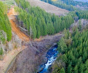
This dam idea isn’t new
Although I’ve lived and worked in the Chehalis Basin for fifteen years, I did not experience the 2007 and 2009 floods first hand. But I vividly remember the footage of catastrophic property damage: dead cattle and images of people and their families devastated by the floods.
Many people in Western Washington were affected by the cascading impacts of those events. A decade after the tragedy, we are still searching for a solution that will make sure the same thing doesn’t happen again.
Reduce flooding around the Twin Cities
Talk of a new dam on the Chehalis River has been around since the 1980s when it was proposed as a way to control flooding and create a recreational destination above Pe Ell. Since then it has taken many forms but the general idea is always the same: hold back water to reduce flooding around the Twin Cities. The idea is that this would limit damage and increase opportunities for development. Unfortunately, the newest dam proposal won’t produce these results.
There has been a lot of information published about the dam—most of it true and some of it not. This article is meant to lay out the facts about the dam and its ability to reduce flood risk in our communities. Let’s begin with the first and most widely-reported claim: the dam will provide substantial flood protection throughout the whole basin.
Not all flooding is alike
There are a few types of flooding that happen along the Chehalis River. Minor and moderate flooding happens every winter, when streams and rivers fill to their banks and sometimes spill over creating shallow pools and soggy fields. This type of flooding is important in sustaining fish and wildlife in the basin.
Then there is major and catastrophic flooding, which happens about every seven years or more when the main stem of the Chehalis River exceeds 38,000 cubic feet per second (cfs) at Grand Mound. This is the type of flooding that forces evacuations, can overtop roads, damage property and in the worst circumstances, result in the loss of life. The most recent events happened in 1990, 1996, 2007 and 2009 and were well over 38,000 cfs. While these types of floods are severe, they are hardly new.
Both Chehalis and Cowlitz history speak of great floods in the basin. The Indigenous names for many places—like the modern-day Black River, which literally means “becomes a lake”—indicate the long history and understanding of these natural flood events. Early settlers were warned by their tribal neighbors to build on the hills outside of the lowland valleys, which they knew regularly filled from valley wall to valley wall. And early settlers heeded those warnings, building on high ground and also witnessing the frequent floods. In the book Centralia, The First Fifty Years, 1845-1900 by H. Smith, one group of settlers described “a sea of water – a mile to dry land in all directions” just south of Centralia.
A dam that targets the Centralia and Chehalis area
The purpose of the proposed dam is to reduce flooding during major or catastrophic events on the main stem of the Chehalis River around Chehalis and Centralia—not the entire basin. It does relatively little to reduce flood damage from moderate or large floods in the Chehalis, and nothing to address floods of other streams and rivers such as those that occurred in the Newaukum and Skookumchuck in 2009. Storms this January caused the Chehalis River to crest at just over 30,000 cfs. A new dam would not have reduced the damage or erosion that occurred.
Heavier winter rains are becoming more frequent, with four major catastrophic floods in 20 years. Projections from the University of Washington Climate Impacts Group confirm increased flooding on the Chehalis. The State Environmental Impact Statement (SEIS) for the new dam projected a 26 percent increase in flooding by 2080. More recent estimates show that this was conservative; flow increases may actually be as high as 50 percent.
A recent letter to the Chronicle makes a blatantly false claim: “those downstream can be at ease knowing the dam will help control flooding in the whole Chehalis watershed to Aberdeen.” Reductions in flood levels will have almost no effect downstream of Centralia, much less Aberdeen. According to the SEIS, even with a dam, more than 56 percent of structures inundated during major and catastrophic flooding events will still be inundated. ”Areas where the [dam] reduces flooding may still be flooded in larger floods like the 2007 flood.”
Misplaced development puts families in danger
Other recent articles and studies claim that the dam will reduce flooding so significantly that new development can occur in previously flooded areas. This is perhaps the most dangerous claim that has emerged. It is a pattern that has repeated itself for over a century across the county—usually with devastating consequences.
Large infrastructure projects like levees or dams are constructed with hundreds of millions of taxpayer dollars. Flood risk is reduced just long enough for people to move in and develop the floodplain. Next, the infrastructure either fails or cannot keep up with a changing environment–the people who moved in pay the price. Their families are in harm’s way. Insurance rates skyrocket while homes and businesses lose value, making it almost impossible to leave.
This is a common trend and one that is entirely preventable, yet Lewis County has not adopted higher floodplain management standards, using FEMA flood maps that were developed in 2010. Relying on old and inaccurate flood maps has increased the flood risk for our community, all for short-term economic gain.
Long-term solutions that benefit communities
A dam is not the best option to limit flood damage. The only way to reduce long-term flood damage is to work with communities to relocate the highest-risk homes and businesses out of flood-prone areas and prevent future development from making the situation worse. If this approach were adopted it would result in massive economic opportunities for our communities in a way that is sustainable given predicted changes in the climate.
We can create a different future for ourselves—one that invests our tax dollars back in our communities to reduce local flood risk and create high-paying local jobs. We can create new business districts and development opportunities on high ground. Building in areas safe from flooding will provide long-term economic growth for our communities.
Today the best thing to do is acknowledge the problem and plan for it by improving local defenses. This includes helping those prepared to move to high ground. It means discouraging development in flood-prone areas. Our kids and grandkids shouldn’t be dealing with this issue in the future, short-sighted solutions that benefit the few at the expense of the many will make the situation worse. Thinking holistically about this issue will enable us to identify long-term basin solutions that are resilient and adaptable. This is what is needed to ensure the long-term prosperity of our communities.
Lee First lives in Grays Harbor County and is a Twin Harbors Waterkeeper.
Chehalis: A Watershed Moment
This 60-minute documentary tells the story of how climate change and a legacy of human impact is affecting Washington’s Chehalis River and the people living in the watershed. Told by the people grappling with decisions that will affect the fate of the river, its salmon and their communities, the film explores the intersection of social, cultural, economic and environmental values that are increasingly being defined by a new climate reality. Available on Amazon Prime.
Be First to Comment